
A rite of passage, that is. There’s no better place to catch the 4WD bug than the Coorong in South Australia. They say that there are moments in one’s life that cast the stone on your destiny. Visiting the Coorong National Park 50 years ago did just that for me. This is the place that awoke my interest in all things 4WD, the place that taught me so much about wild spaces. The Coorong draws me back time and again. It’s a place that’s super-special in a world when mere ‘special’ is criminally overused.
MAN VERSUS NATURE
The Coorong is a coastal lagoon ecosystem and one of the world’s longest beaches. It’s a pristine and primal ribbon of sand stretching from the Murray mouth at Goolwa and southwards to just shy of the crayfishing town of Kingston, at a place known as The Granites. It includes the mighty 90 Mile Beach and is the ancestral home of the Ngarrindjeri people. The area is officially the Younghusband Peninsula and is unique in the world in having a series of saline lagoons, wedged between the typically roaring Southern Ocean and the scrub adjacent to the Princes Highway. To get there is a 2.5-hour journey from Adelaide, via Tailem Bend then Meningie, to Salt Creek.
Those lagoons are protected critical wetlands by international treaty and are a haven for migratory birds, some of which fly in from Alaska. They are linked to the ocean from the mouth of the Murray but low flows of freshwater in earlier times had early European settlers nervous about how far upstream the saltwater might go, rendering irrigation useless. A brutal solution was found. In the 1930s, barrages were constructed— a man-made barrier of steel shutters and locks preventing saltwater intrusion into the Lakes (Albert and Alexandrina and their feeder rivers). This was a time when ecology played second-fiddle, with the result that freshwater was prevented from flushing the mouth and recharging the Coorong forever. That likely wouldn’t happen today.

HISTORY (AND HOVERCRAFTS)
My first Coorong visit was as a teenager back in 1974. I was a city kid and my parents had to drag me along on a visit to some of their friends, who were park rangers. Thank heavens they did. Imagine the bragging rights I got at school the following week with my tales of shooting my first rabbit(s) and driving the National Parks and Wildlife Service (NPWS) 4WD! Not to mention leaping off dunes while standing on the back of a V8 spaceframe beast—in a section claimed by the local dune buggy club!—plus catching lots of Coorong mullet, and joining a ranger on patrol … in a hovercraft.
Back then the NPWS had decided that wheeled vehicles in this landscape posed too many mobility problems as tracks were few. Greater access would be gained, they hoped, by one of those new-fangled hovercraft thingies. Well, there were good hovercraft days and bad. The good days would see us effortlessly skimming over the water in the lagoons, and across the pipeclay. But for bird-spotting? Forget it. The combined racket of the engine and fan was like trying to sneak up on a poetry recital when you’re an AC/DC concert.
BOOM AND BUST
The Old Coach Road (now known as the Loop Road or Old Coorong Road) was the main thoroughfare when en-route to Melbourne from Adelaide and carried a mix of horse-drawn passenger coaches, bullockies and drays. It also became a thoroughfare for Chinese immigrants en route to the 1850s Victorian goldfields.
European diggers on the fields resented the influx of Chinese and lobbied the Victorian Government to do something about it. Their reaction was to levy a then-whopping £10 poll tax on anyone who landed in a Victorian port. The immigrants’ reaction, unsurprisingly, was to disembark at Adelaide and later Robe instead, then take the long march overland to Bendigo and Ballarat, hundreds of kilometres away. There are reminders of that slog. Chinaman’s Well (another name unlikely to be coined today) is one, built by a stonemason to provide reliable fresh water in all weather. It’s near Salt Creek.
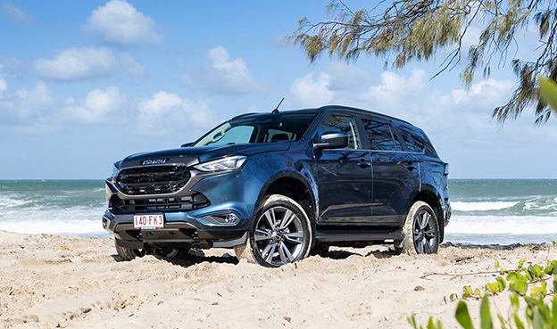
Salt Creek is also where you’ll find the original NPWS HQ built in the 1970s and now used by SES and CFS fire crews. There’s also a monument to another commercial endeavour in the form of a replica oil rig. A chance discovery of a bituminous algae sludge called coorongite in 1892 was mistaken for oil, mining leases were issued and companies bankrolled to drill for it. All for nought. Naturally occurring near fresh water lakes, coorongite is flammable, but it wasn’t ever going to power a horseless carriage, especially our new MU-X.
WHERE TO GO
Driving into the park from Salt Creek and following the Old Coach Road, the first point of 4WD merit is the link track to access Tea Tree Crossing (TTX). This is a stunning way to get to the magnificent beachfront and is at the safest end to start for the run down to 42 Mile Crossing. Usually from November until around May you’ll be able to navigate the lagoon’s crossing to TTX. An orange-tipped row of markers defines the route and the depth of the water. It’s salt and it’ll be closed when the water is deeper than about 100mm, like it was on our visit this Spring.
If it’s open, you be able to navigate the pipeclay to the beautiful TTX campgrounds (no facilities) where a plain of grasslands is hemmed by the melaleuca fringing the lagoon and the acacia holding the fabric of the sandhills together. It’s a great place to get out of the wind, and I guarantee you’ll see emus and kangaroos grazing nearby. The jump-up dune behind camp will be your first trial. If it has been warm you can expect the sand will be dry and tricky, and a big tyre pressure dump will be required to get you up and over. I’ve had some visits need as little as 15psi/100kPa to make it look easy. Try either first gear high range or third or fourth in low and don’t be afraid to use some welly!
Once over that little obstacle the track winds its way west easily and to the beach through beautiful sandhills steeped in Aboriginal history because this is a place of plenty. It was home to some of the densest populations in the continent before the white man arrived, and foragers have for thousands of years collected Goolwa pipis, or cockles, for big cook-ups in the dunes. The Ngarrindjeri left plenty of evidence of these feasts with their midden heaps, piles of shells revealed by the winds and re-covered over time. In case you were wondering, Coorong is an English derivation of Kurangk, the name the original locals called the place.

BEWARE THE MURRAY MOUTH U-TURN
Once you’re on the beach there’s a T-junction. Turn right (north) and you’ll bump into the Murray mouth in a couple of hours (be warned, there’s no exit at the other end so you’ll have to retrace your steps) or turn left (south) and you’ll run down the beach towards 42 Mile, the easiest section, as the trail stays mostly up above the high tide mark. Beware: beyond this point, it doesn’t.
This beach isn’t for the fainthearted. The sands are particularly difficult at any time of the year as they contain a lot of shell grit and it forms in waves, scoured by the action of the sea as it bashes up against the foredune. At high tide, the beach will be non-existent in places and there are precious-few escape routes. With grip harder to find than an oat milk latte and further complicated with a steep side slope to the water’s edge, it’s all about plenty of engine-speed, straight steering and low tyre pressures. Plenty of cars have been claimed by the sea between here and The Granites. Best not to join them.
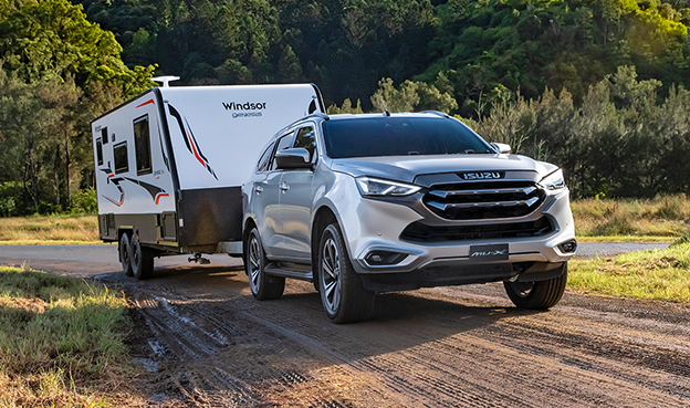
Don’t be dissuaded from having a look, though—the other tracks that comprise the crossings of 32 Mile, 28 Mile and The Wreck will get you from the highway, through the lagoon hinterland to the beach for a stickybeak that’s worth the effort. If you’ve got a camper or a caravan there are several designated campsites. NPWS has spent plenty of money there in recent years upgrading the facilities since COVID’s descent put plenty of locations under stress—and it shows. On the other hand, if bush camping is your preference, you’ll find plenty of alternate serenity.
You’ll also find motel accommodation nearby at either end of the park—Meningie to the north and Kingston in the south—but I like to mark my endpoint in Robe. Just like the hardy disembarking Chinese prospectors of the 1850s, Robe marks the start of another epic journey, although this one is of a 4WD kind. The beaches of the south-east, including the stunning Nora Creina and the magical Beachport, are worth their weight in gold. Beware, though. Drag your children there at your peril. You may doom them to a wonderful life of off-roading addiction.


